Author = Alwan, Imzahim A.
Number of Articles: 3
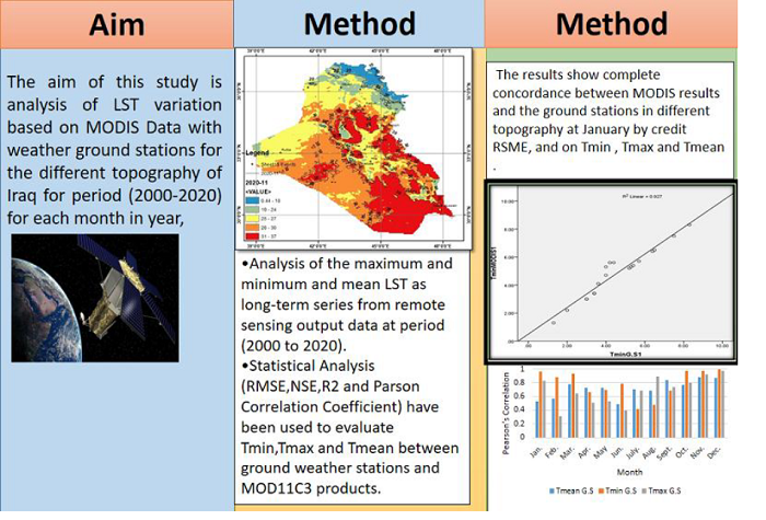
Integrated Approach for Land Surface Temperature Assessment in Different Topography of Iraq
Volume 40, Issue 11 , November 2022, , Page 1465-1486
Abstract
Land Surface Temperature (LST) is a critical parameter for water resources and hydrology investigation. Weather ground stations provide a continuous dataset on the LST. However, some ... Read More ...
Water Flow Simulation of Tigris River Between Samara and Baghdad Based on HEC-RAS Model
Volume 39, Issue 12 , December 2021, , Page 1882-1893
Abstract
This work aims to use the digital elevation model (DEM) or 3-Dimensional surface to model and analyze the water flow in the Tigris River. The first stage of this study is based on filed ... Read More ...
Utilization of Satellite Images-Based Indices for Assessment of Al-Hammar Marsh Restoration plan
Volume 39, Issue 8 , August 2021, , Page 1328-1337